The University District (or University Area), is a 2.8-square-mile area located 2 miles (3.2 km) north of Downtown Columbus, Ohio that is home to the main campus of Ohio State University, the Battelle Institute, and Wexner Medical Center. It is generally accepted as the area bounded to the north by Clintonville at Glen Echo Ravine; to the south by the Short North at 5th Avenue; to the west by the Olentangy River and to east by the Conrail railroad tracks. Points of interest include, but are not limited to, the Ohio Stadium and Old North Columbus. The district is Columbus’ most densely populated area and contains more than 650 businesses, human service agencies, churches, and schools. (Source: Wikipedia)
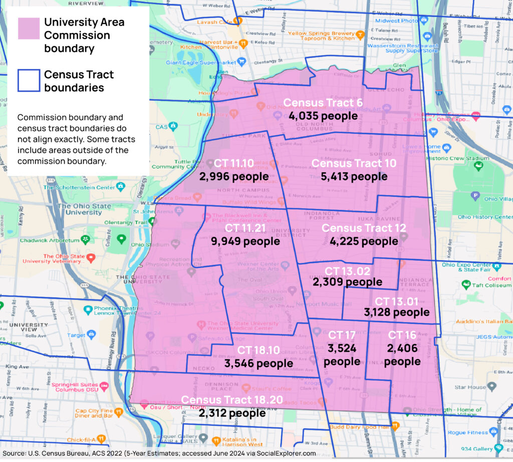
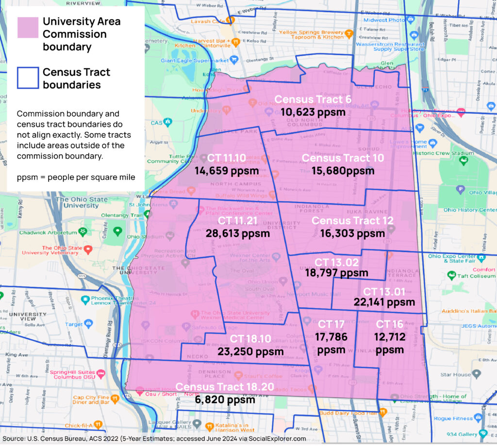
Selected data and maps for 11 census tracts mostly within UAC boundaries
[Based on 2022 ACS U.S. Census Bureau 5-year estimates]
Total population: 43,843
Median age: 22.9
Population by census tract

Population Density

Population density: 16,363.9 people per square mile
City of Columbus population density: 4,095 people per square mile
Franklin County population density: 2,476 people per square mile
Other Data
| White Alone | 32,957 | 75.2% |
| Black or African American Alone | 3,621 | 8.3% |
| American Indian and Alaska Native Alone | 27 | 0.1% |
| Asian Alone | 4,150 | 9.5% |
| Native Hawaiian and Other Pacific Islander Alone | 0 | 0% |
| Some Other Race Alone | 415 | 1.0% |
| Two or More Races | 2,673 | 6.1% |
Housing units: 15,914
Median year structure built: 1950
Occupied Housing Units: 13,685
Owner Occupied: 12.7%
Renter Occupied: 87.3%
Population in Group Quarters: 2,268 — 28.0%
| Means of Transportation to Work for Workers 16 Years and Over | ||||||
| Workers 16 Years and Over: | 23,868 | — | ||||
| Car, Truck, or Van | 13,449 | 56.4% | ||||
| Drove Alone | 12,195 | 51.1% | ||||
| Carpooled | 1,254 | 5.3% | ||||
| Public Transportation (Includes Taxicab) | 1,435 | 6.0% | ||||
| Motorcycle | 0 | 0% | ||||
| Bicycle | 442 | 1.9% | ||||
| Walked | 5,013 | 21.0% | ||||
| Other Means | 145 | 0.6% | ||||
| Worked At Home | 3,384 | 14.2% | ||||
